New Underwater 3D Images Show "Sheer Magnitude" Of Salvage Operation Ahead for the Baltimore Bridge (update)
Local, state, or federal officials have yet to offer a timeline for salvage crews to completely remove the collapsed bridge from the main shipping channel entering the Port of Baltimore.
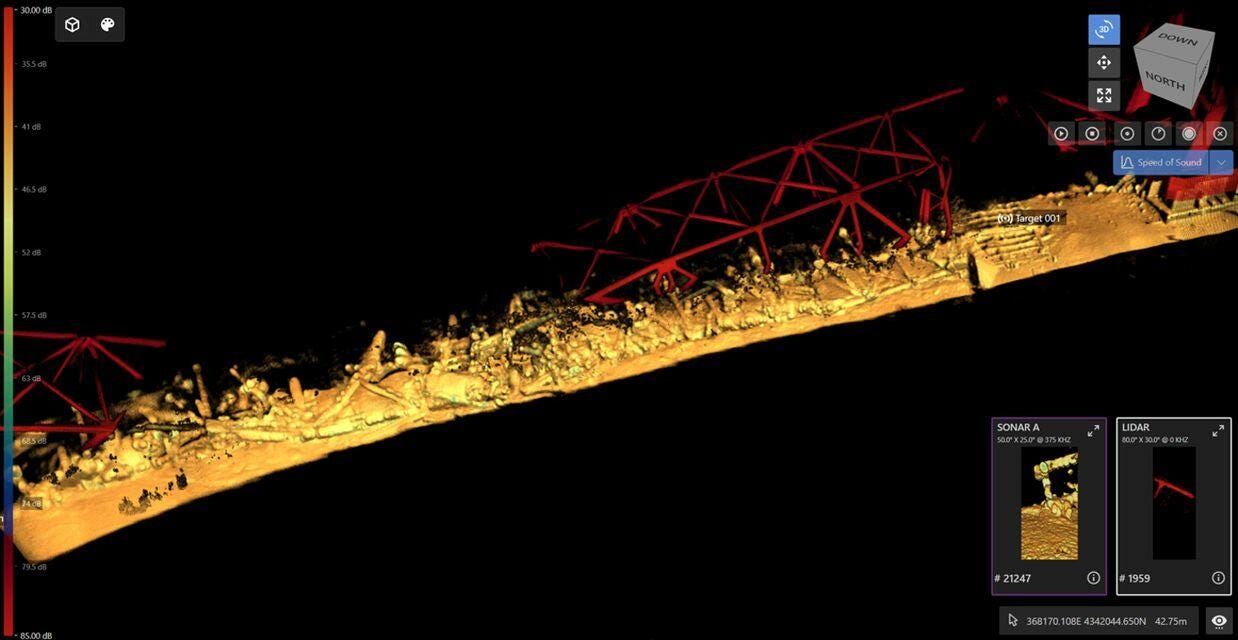
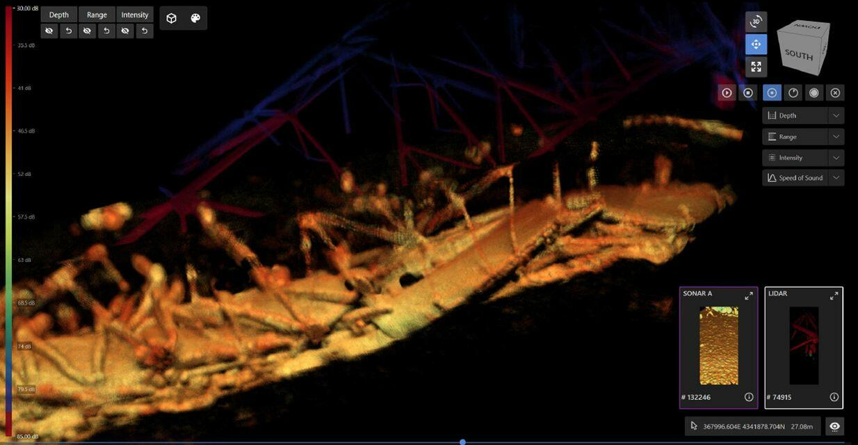
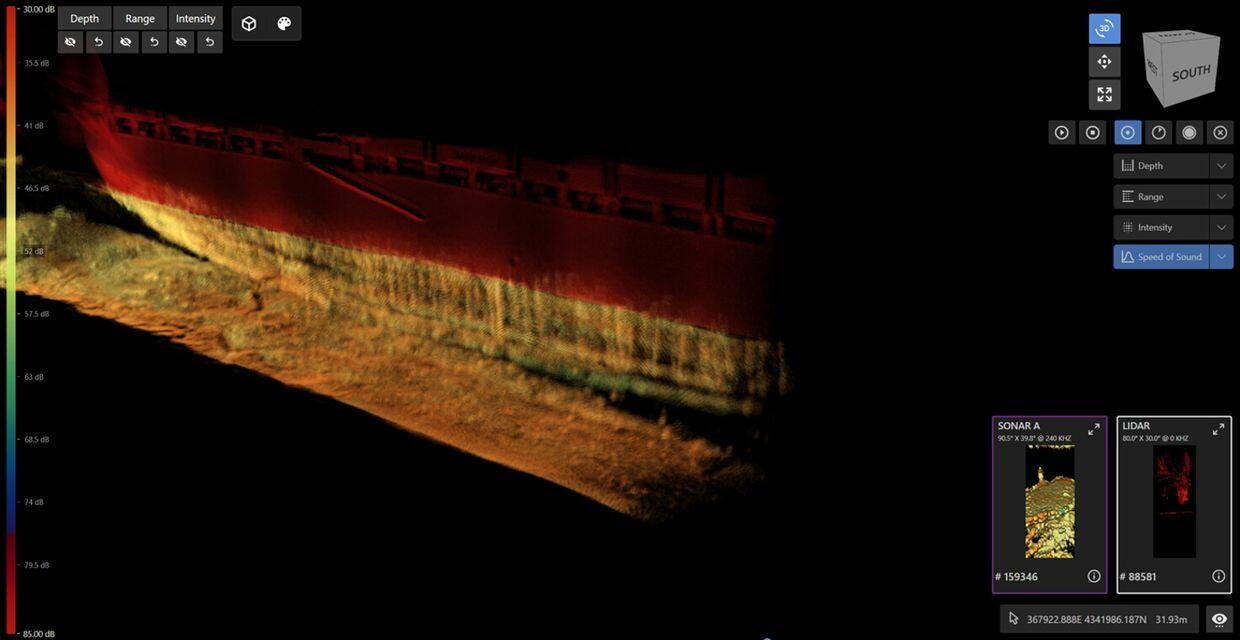
On Tuesday morning (April 2, 2024), the Baltimore District, US Army Corps of Engineers published new 3D images of the wreckage at the bottom of the shipping channel on social media.
"These 3D images show the sheer magnitude of the very difficult and challenging salvage operation ahead," the US Army Corps of Engineers said in a Facebook post.
The post continued, "The underwater sonar imaging tool, known as CODA Octopus, is the primary survey tool used by divers, with visibility clouded to just one to two feet because of the four to five feet of mud and loose bottom of the Patapsco River."
"Divers are forced to work in virtual darkness, because when lit, their view is similar to driving through a heavy snowfall at night with high-beam headlights on. So murky is the water, divers must be guided via detailed verbal directions from operators in vessels topside who are viewing real-time CODA imagery," Army Corps of Engineers pointed out.
They added that "no usable underwater video exists of the wreckage" because, as one Navy diver put it, "there's no need to take video of something you can't even see."
The complexity of this salvage operation suggests the main shipping channel will be closed for weeks if not months.
Full post available on ZeroHedge…


